Foothills Parkway is one of the easiest ways to experience panoramic Smoky Mountain views without committing to a long hike or spending the day in the busiest areas of Great Smoky Mountains National Park.
The connected western sections of Foothills Parkway, Tennessee run approximately 33 miles from Chilhowee Lake to Wears Valley, following ridges above Walland, Townsend, and the surrounding foothills.
From one side of the road, overlooks face Great Smoky Mountains National Park. From the other, views stretch across the Tennessee Valley toward Maryville, Alcoa, and the Cumberland Plateau on clear days.
For guests staying at Tremont Lodge & Resort, the Walland entrance to the Foothills Parkway scenic drive is only about ten minutes west on Highway 321.
Drive it late in the day for sunset, during October for changing leaves, or anytime you want one of the best scenic drives near Townsend without spending hours in the car.
The portion of Foothills Parkway, TN most relevant to Townsend visitors is known as Foothills Parkway West.
Today, the western route extends approximately 33 continuous miles from Chilhowee Lake to Wears Valley.
The section from Walland toward Wears Valley is the newest and includes the engineering project commonly called the Missing Link.
The section southwest from Walland toward Chilhowee Lake is older and includes Look Rock, numerous mountain overlooks, picnic areas, and views toward both Great Smoky Mountains National Park and the Tennessee Valley.
You may occasionally see travelers search for Foothill Parkway without the “s.” They are generally looking for the same scenic parkway in Tennessee.
If you are starting from Tremont Lodge, the most convenient access point is near Walland on U.S. 321.
From there, you have two primary directions to explore.
Drive east from Walland toward Wears Valley to experience the newest completed portion of Foothills Parkway.
This route includes:
This is our recommendation if you only have an hour or two.
Drive southwest from Walland toward Chilhowee Lake for the older portion of Foothills Parkway West.
This route includes:
If you have more time, this makes an excellent half-day scenic drive.
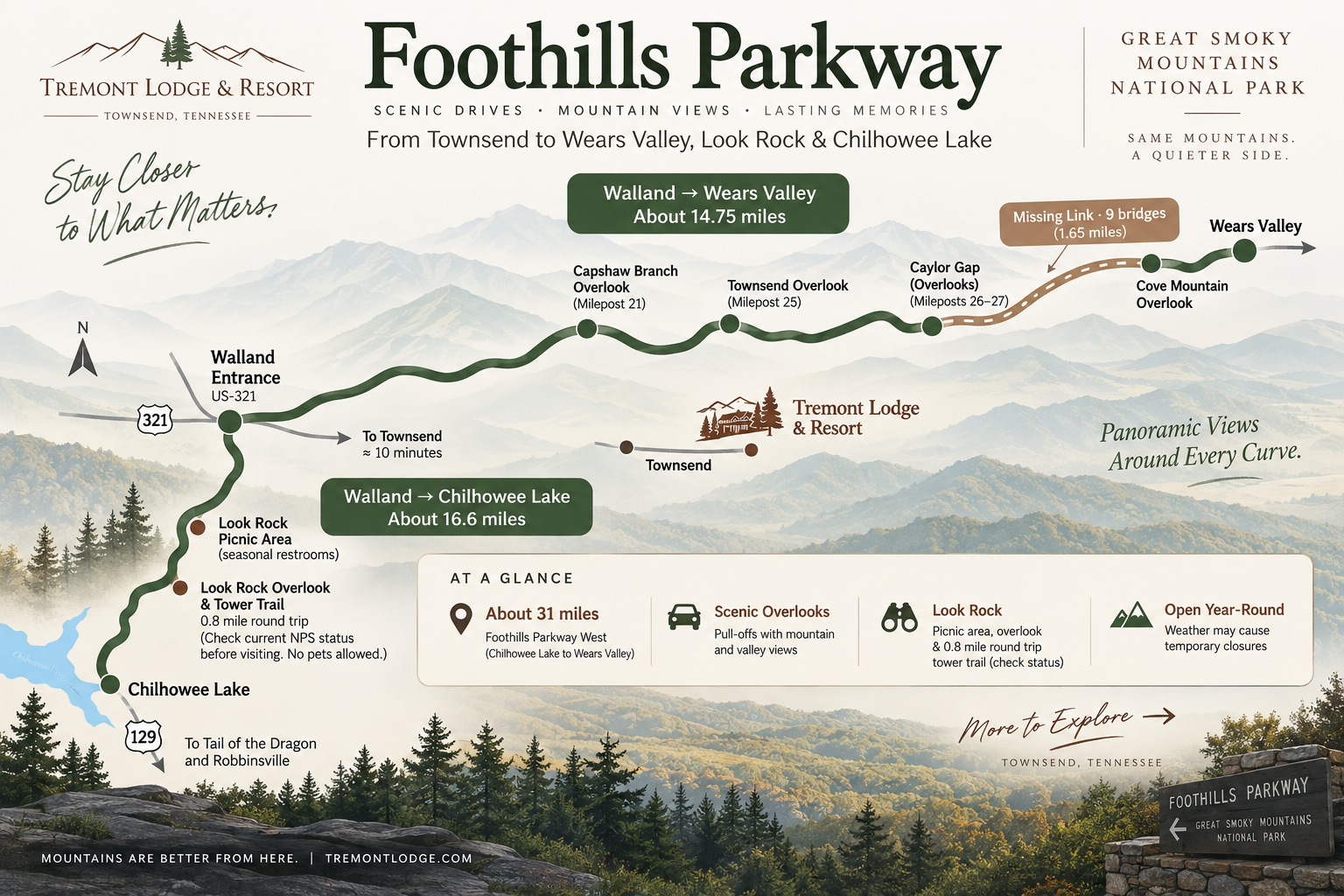
Foothills Parkway map showing the western sections from Chilhowee Lake through Walland to Wears Valley near Townsend, Tennessee.
Foothills Parkway has one of the most unusual road-building histories in the Smoky Mountains.
The idea for a scenic parkway along the Tennessee side of Great Smoky Mountains National Park dates to the 1930s.
Congress authorized the project in 1944, creating a planned approximately 72-mile scenic corridor along the northern and western edges of the park.
Construction began in the 1950s.
The project was divided into multiple sections of the parkway, identified by the National Park Service as Sections 8A through 8H.
Some portions were finished relatively quickly.
Others were not.
Decades of difficult mountain terrain, engineering challenges, changing funding, and environmental planning slowed the project so much that the National Park Service today describes Foothills Parkway as the oldest unfinished highway project in Tennessee.
In other words, one of the best scenic drives in the Smokies is still technically an unfinished highway project in Tennessee more than 80 years after Congress authorized it.
The most famous construction challenge occurred between Walland and Wears Valley.
Work on this portion began in the 1960s, but engineers eventually encountered an especially difficult approximately 1.6-mile stretch of steep terrain.
Construction stopped in this area in 1989.
The unfinished stretch became known as the Missing Link.
Instead of cutting aggressively into the mountainside, engineers redesigned the route using a series of bridges and viaducts that carry the roadway across the steep terrain.
The National Park Service ultimately completed approximately 16 miles of roadway between Walland and Wears Valley, including the Missing Link.
That section opened to the public in November 2018.
Its completion connected the older western sections and created the approximately 33 continuous miles of Foothills Parkway West visitors can drive today.
The project involved cooperation between the National Park Service, State of Tennessee, Tennessee Department of Transportation, Federal Highway Administration, and other partners.
No.
That is part of what makes the road’s history so unusual.
The original Foothills Parkway corridor was planned to extend approximately 72 miles, from Chilhowee Lake in the west toward Interstate 40 east of Cosby.
Several completed sections are open today, but the entire planned corridor has never been built.
The connected western sections extend approximately 33 miles from Chilhowee Lake to Wears Valley.
This is the Foothills Parkway route most relevant to visitors staying in Townsend.
The eastern section runs approximately 6 miles from the Cosby area toward Interstate 40.
It was completed decades before the Missing Link and offers a completely separate Foothills Parkway experience with views toward Mt. Cammerer and the eastern Smokies.
Several planned sections between Wears Valley and the eastern portion have never been constructed.
Planning work has continued on portions of the remaining corridor, but as of 2026, you still cannot drive one continuous Foothills Parkway from Chilhowee Lake all the way to Interstate 40.
The right-of-way for the planned corridor was transferred to the United States and is administered as part of Great Smoky Mountains National Park.
You do not have to stop at every pull-off to enjoy the drive.
But several places are worth building into your route.
Townsend Overlook is one of the best stops for guests staying on the peaceful side of the Smokies.
Located on the Walland-to-Wears Valley portion of the parkway, the overlook provides views toward Townsend and the surrounding mountains.
It is especially attractive during late-afternoon light.
Near the higher elevations of the Walland-to-Wears Valley route, Caylor Gap offers broad panoramic views across rolling ridges and Great Smoky Mountains National Park.
There are multiple parking areas nearby, making this an easy place to stop and stretch your legs.
Capshaw Branch Overlook offers substantial parking and another broad mountain view along the newer section of Foothills Parkway.
It is particularly convenient for families, groups, and travelers who want a scenic stop without hiking.
Look Rock is one of the signature stops on the Chilhowee Lake side of Foothills Parkway West.
The area includes roadside viewpoints and access to the Look Rock Tower Trail.
The paved Look Rock Tower Trail is approximately 0.8 mile round trip.
It includes mild-to-moderate inclines and leads toward the observation tower for panoramic views across the mountains and Tennessee Valley.
Trail and tower conditions can change because of maintenance or weather. Check current National Park Service alerts before making Look Rock the centerpiece of your drive.
Pets are not permitted on the Look Rock Tower Trail, even though pets are allowed on park roads, in picnic areas, and in campgrounds.
The nearby Look Rock Picnic Area gives visitors a place to turn the scenic drive into a longer outing.
Pack lunch in Townsend and spend some time on the ridge instead of immediately driving back down.
Restrooms are available seasonally.
The southwestern end of Foothills Parkway West reaches U.S. 129 near Chilhowee Lake.
From here, travelers can turn around or continue toward other scenic roads in East Tennessee.
Every season creates a different experience.
Spring brings new green growth, wildflowers, and clearer views before heavier summer haze arrives.
Summer covers the mountains in deep green. Late afternoon and sunset are especially good times to drive.
Fall is one of the most popular seasons on Foothills Parkway. Because the road follows elevated ridges, fall color can sometimes develop here before it reaches the lower valleys around Townsend.
Winter can provide exceptional long-distance visibility, but snow, ice, wind, and weather conditions can temporarily close portions of the parkway.
For photography, late afternoon through sunset is one of our favorite times to go.
Always check National Park Service road conditions before driving during questionable weather.
There is not a traditional visitor center located directly along most of Foothills Parkway West.
Before heading up the mountain, visitors staying in Townsend can stop at the Townsend Visitor Center on U.S. 321 for local information, maps, restrooms, and trip-planning help.
The National Park Service also notes that Cades Cove Visitor Center is one of the closest official park visitor centers to Foothills Parkway West, depending on where you are along the route.
Saving a park map before leaving Townsend is helpful because cellular service can vary in the mountains.
For Foothills Parkway West, Townsend puts you right where you want to be.
The Walland entrance is only about ten minutes west of Tremont Lodge on Highway 321.
That means you can look outside late in the afternoon, decide the weather looks perfect for sunset, and be climbing toward the overlooks shortly afterward.
There is no need to cross Gatlinburg or Pigeon Forge first.
Townsend also keeps you close to Cades Cove, Tuckaleechee Caverns, hiking, waterfalls, horseback riding, and the Little River.
You spend more of the trip experiencing the Smokies and less of it driving through traffic to reach them.
Foothills Parkway and Cades Cove offer two very different ways to experience the Smokies by car.
Foothills Parkway gives you elevation, long-distance views, and mountain ridgelines.
Cades Cove puts you down inside a broad valley filled with wildlife, historic buildings, hiking trails, and open fields.
Use our Cades Cove Loop Road guide before you go.
Tuckaleechee Caverns is only minutes from Tremont Lodge and works particularly well when weather changes your outdoor plans.
The guided underground experience includes massive cave formations, the Big Room, and the 210-foot Silver Falls.
Read our Tuckaleechee Caverns guide.
Spend the morning hiking and save the parkway for late afternoon when everyone is ready to see the mountains from the car.
Compare the best hiking trails near Townsend before choosing a trail.
Townsend also provides access to several waterfall hikes that can easily be paired with a scenic drive.
Explore our guide to the best waterfalls near Townsend.
For a completely different way to see the Smokies, trade the car for a horse.
Our horseback riding near Townsend guide covers nearby options including Davy Crockett Riding Stables and Cades Cove Riding Stables.
Foothills Parkway is one of the easiest Townsend activities to recommend because almost anyone can enjoy it.
Families can see mountain views without asking young children to complete a long hike.
Couples can make the parkway part of a sunset drive.
Photographers can move between overlooks as the light changes.
Older travelers and people with limited mobility can access mountain scenery from roadside viewpoints with accessible parking available at many stops.
And groups can use the drive as a slower activity between more demanding days of hiking, horseback riding, or exploring Great Smoky Mountains National Park.
For more ideas, browse our complete guide to things to do in Townsend, TN.
Foothills Parkway runs along the Tennessee side of Great Smoky Mountains National Park.
For Townsend visitors, the most relevant portion is Foothills Parkway West, which extends approximately 33 continuous miles from Chilhowee Lake through Walland to Wears Valley.
The original planned Foothills Parkway corridor is approximately 72 miles long, but it has never been fully completed.
The connected western route visitors typically drive near Townsend is approximately 33 miles from Chilhowee Lake to Wears Valley.
The Missing Link was an approximately 1.6-mile portion of the Walland-to-Wears Valley project where steep terrain and unstable geology made traditional road construction extremely difficult.
Engineers eventually completed the crossing using a series of bridges and viaducts.
The roughly 16-mile Walland-to-Wears Valley project opened to the public in November 2018.
Difficult terrain, geology, funding changes, environmental review, and complex engineering have repeatedly delayed construction since the project began.
The National Park Service calls it the oldest unfinished highway project in Tennessee.
Not continuously.
The separate eastern section extends from the Cosby area toward Interstate 40, while several middle portions of the originally planned 72-mile corridor remain unfinished.
For the Walland-to-Wears Valley section, allow around one to two hours if you want to stop at several overlooks.
Driving more of the 33-mile western route, visiting Look Rock, taking photos, or stopping for a picnic can easily turn the trip into several hours.
Yes. There is no admission ticket or reservation required simply to drive Foothills Parkway.
A Great Smoky Mountains National Park parking tag is required when parking for more than 15 minutes.
If you stop and leave your vehicle parked for more than 15 minutes, you need a valid Great Smoky Mountains National Park parking tag.
Foothills Parkway is generally open year-round, but weather, snow, ice, high winds, road work, or other safety conditions can cause temporary closures.
Check current National Park Service alerts before your drive.
As of September 2026, current National Park Service information does not list Look Rock Tower among the park's active closures.
Because tower and trail conditions can change, check the current NPS alerts page before driving specifically to Look Rock.
The Look Rock Tower Trail is approximately 0.8 mile round trip, not 0.8 mile each way.
The paved route includes mild-to-moderate inclines.
No.
Pets can ride with you on Foothills Parkway and are permitted on park roads and in certain developed areas, but dogs are not permitted on the Look Rock Tower Trail.
For guests staying in Townsend, the Walland-to-Wears Valley section is an excellent choice for a shorter drive because it includes the Missing Link, dramatic bridge construction, Townsend Overlook, Caylor Gap, and numerous mountain viewpoints.
For a longer outing, drive from Walland toward Look Rock and Chilhowee Lake.
Yes.
Late afternoon and sunset can create dramatic layers of light across the Smoky Mountain ridges and Tennessee Valley.
Conditions vary daily, so clear or partly cloudy evenings usually offer the best opportunities.
Yes. Foothills Parkway is administered by the National Park Service as part of Great Smoky Mountains National Park.
The official name is Foothills Parkway.
“Foothill Parkway” is a common singular spelling used by people searching for the same scenic road in Tennessee.
Foothills Parkway is one of those Smoky Mountain experiences that does not require months of planning.
When the sky clears, fall color looks especially good, or sunset is shaping up to be worth the drive, you can leave Townsend and be climbing toward the parkway within minutes.
Tremont Lodge & Resort puts you close to the Walland entrance while keeping Cades Cove, Tuckaleechee Caverns, hiking, waterfalls, horseback riding, and the Little River nearby.
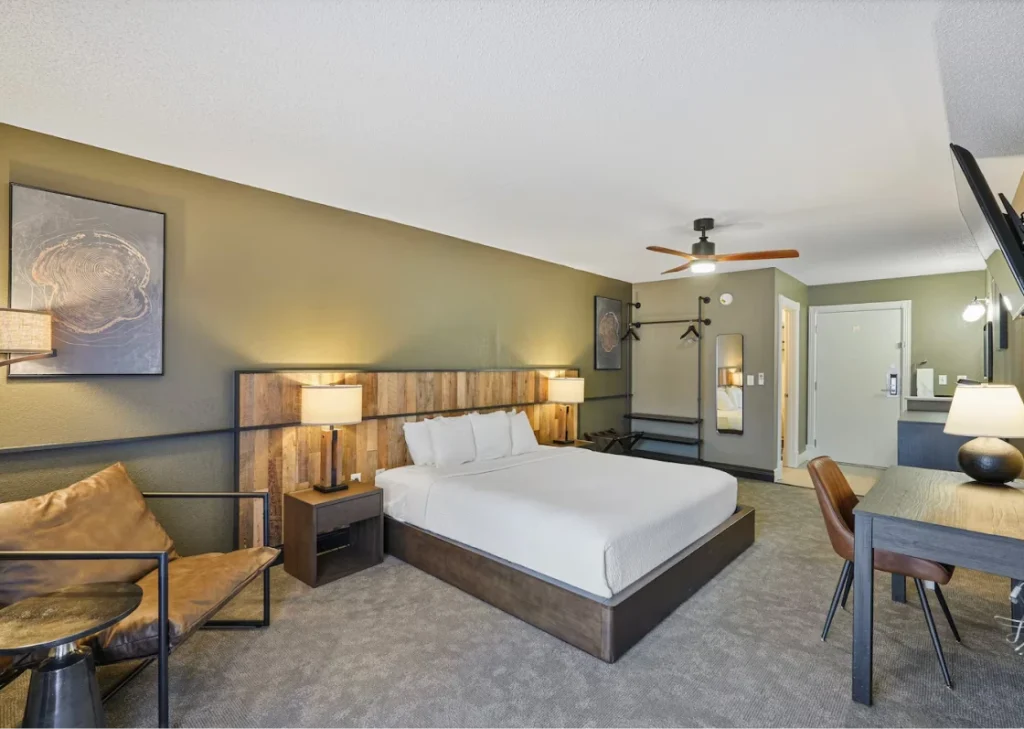
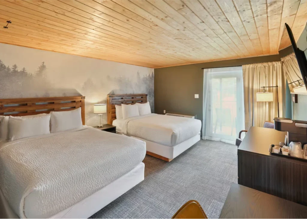
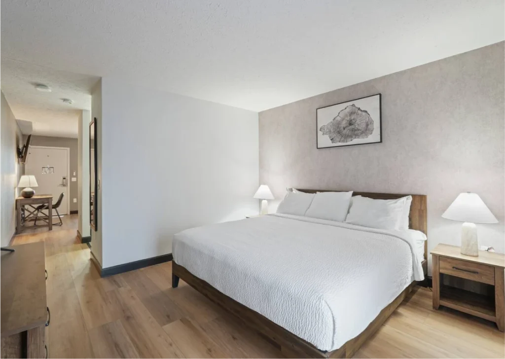
After the drive, return to renovated rooms, pools, a hot tub, outdoor spaces, and the other amenities around the resort.
Stay updated with our latest additions and upgrades, last- minute openings, and a chance to win a FREE stay!